

Choisissez un modèle pour pouvoir sélectionner un favori
Earthquakes in France
from
Réf.
10,00 € inc. VAT
Modèle :
|
Ressources
|
Forensics
Living organisms
Prepared slides
Glassware
Grounded glassware
Laboratory equipment
Earthquakes in France
|
Ressources
|
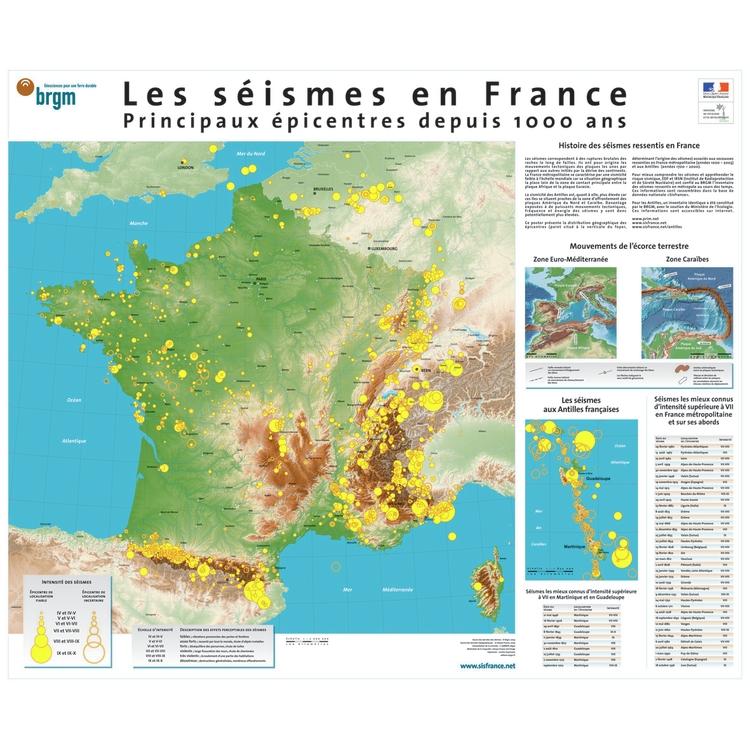
Main epicentres in the last 1,000 years
This poster presents, on the map of metropolitan France at 1/2,000,000 and on the map of the French Antilles at 1 / 1,850,000, the geographical location of the main epicentres of earthquakes that have occurred over the last 1,000 years.
These epicentres are associated with tremors felt in mainland France (from 1000 to 2003) and in the West Indies (from 1700 to 2000).
Format : 88 x 73 cm
Réf : PSFSEI
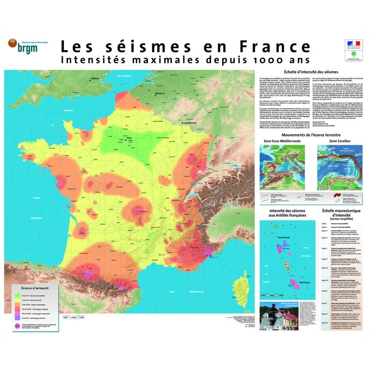
Maximum intensities for 1000 years
Produced for the MEDD (Ministry of Ecology and Sustainable Development), this poster presents the spatial distribution of the most violent intensities (maximum) felt in mainland France, years 1000 to 2004, on a 1/2,000,000 map and those felt in the French West Indies, from the years 1700 to 2004, on a map at 1/1,850,000.
Format : 88 x 73 cm
Réf : PSF2

